

[Editor’s Note: As long term readers of the Mad Scientist Laboratory know, a contemporary U.S. Army maneuver Brigade Combat Team (BCT) has over 2,500 pieces of equipment dependent on space-based assets for Positioning, Navigation, and Timing (PNT). This number of dependent systems will only increase as emerging technology on Earth demands increased bandwidth, new orbital infrastructure, niche satellite capabilities, 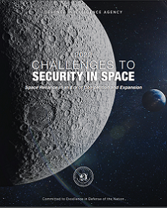 and advanced robotics. But what if we are denied our long-standing dominance in the Space Domain, losing our heretofore omnipresent Global Positioning System (GPS) capability? Per the Defense Intelligence Agency‘s Challenges to Security in Space 2022: Space Reliance in an Era of Competition and Expansion — “China has … developed and probably will continue to develop weapons for use against satellites in orbit to degrade and deny adversary space capabilities.”
Today’s submission by guest blogger CPT Matthew R. Bigelow addresses the ramifications of GPS as a “single point of failure” — creating “friction in our kill chain systems, with wide-ranging effects from sensor to decision-maker to shooter.” CPT Bigelow explores three possible alternative capabilities to GPS that could help ensure continued PNT for the U.S. and its allies and partners on the battlefield of 2040. Read on to learn how this “navigation PACE plan” could preserve U.S. options for succeeding in future competition and conflict!]
Introduction
The battlefield of today and beyond involves space, a domain that includes a sophisticated orbiting system connected to the current changes in the character of war. These changes include hypersonic and anti-satellite (ASAT) missiles, artificial intelligence (AI), self-aware machine learning, robotics, biotechnology, three-dimensional printing, and quantum computing. The increased significance of this geographic or physical domain is due to our adversaries’  modernization efforts and our shift in focus from counterinsurgency operations to Multi-Domain Operations. In addition, over the last two decades, our adversaries have demonstrated kinetic strike and non-kinetic ground-based interference capabilities targeting our orbiting systems, specifically against the Global Positioning System (GPS). Examples include the Chinese fractional orbital bombardment system demonstration in 2021 and the Russian electronic interference with Norwegian GPS in 2017.1 Without the Space Domain, there are breaks or friction in our kill chain systems, with wide-ranging effects from sensor to decision-maker to shooter.
Recent conflicts highlight the importance and utility of space systems with loitering munitions and drones. The 2020 Nagorno-Karabakh conflict, the proxy wars in Libya and Syria, as well as the current war in Ukraine are recent examples of space reliance for delivery of specific system effects. Dependence on space will continue to increase in the decades to come due changes in the character of war. Combat operations, mission command, and visualization of the battlefield are hindered without space-enabled capabilities and their efficacy. This is especially true with GPS disconnection through various forms of adversarial obstruction efforts: downlink / uplink interference, an ASAT strike, or cyber-attacks. With future systems developing and expectations to fight arrayed in a dispersed and disaggregated contested environment, GPS becomes more important on the battlefield of 2040 and beyond.
U.S. Army force structure, design, and modernization efforts should address these challenges. At the minimum, GPS deserves further discourse amongst strategists and planners for preparation of future conflicts and changes to the character of war. This paper argues the importance of hardening the defenses and protecting our GPS system, building a “PACE” (Primary, Alternate, Contingency, and Emergency) plan for navigational continuity during Large-Scale Combat Operations (LSCO), and increasing our awareness of the space domain.
Problem & Threats
GPS is essential during LSCO. However, there is risk to the complete reliance on the current space architecture and orbiting constellation system. The US has relied on this capability since the Gulf War with demonstrations of precision strike and beyond line-of-sight (BLOS) communications against Iraq in 1991 and 2003. GPS enabled quick victories in both conflicts. Unfortunately, the US no longer maintains overmatch in space. Adversaries studied the enablers of U.S. battlefield success and devoted more attention to space with incorporation into their defensive plans, specific to anti-access / aerial denial and protection against regime collapse. The US has come to rely on persistent and encrypted GPS connectivity since the end of the Cold War. Robert Hoffman, Chief, Space Operations Training Division, Space and Missile Defense School explains it best: “The Department of Defense (DoD) needs to focus its efforts on modernizing the way it delivers positioning, navigation, and timing (PNT). Without a fundamental shift away from GPS, the DoD will not be competitive in near-peer conflicts.”2 This is a challenge to national security and the American way of war: offensive combined arms maneuver with Joint and allied / partner integration and reliance on advanced systems and capabilities for overmatch.
Historical Analogy


The historical equivalent of GPS utility and dependence are the Japanese use of wireless telegraphy against Russia in 1904 and German incorporation of the radio within their 1940 Blitzkrieg of France. These capabilities, changes in the character of war in the early twentieth century, enabled Japan and Germany with battlefield advantage against their opponents, granting them the ability to disperse forces, maintain communication, and execute mission command. Russia and France possessed wireless telegraphy and the radio; however, Japan and Germany adapted faster during inter-war periods and utilized these capabilities synchronously and efficiently in combat with protection.3 The lesson learned: navigation capabilities, like telegraphy and the radio, is paramount for successful battlefield outcomes. The party that adapts to the changes in the character of war the fastest may have battlefield advantage. Protection of GPS and navigation capabilities will continue to give the US an advantage in combat.
GPS Background – A Single Point of Failure and an Attractive Target
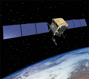
The genesis of GPS dates to the 1970s during the third industrial revolution that focused on innovation of industrial systems, automation, and technology. Due to competition with the Soviet Union and fear of nuclear war, the DoD started experimenting with finding a reliable and precise means of navigation. Existing systems did not meet military purposes and there were concerns of vulnerabilities. The current GPS system architecture consists of 24 satellites with spares in medium-earth orbit, managed by the DoD. Since the 1980s, GPS is available for commercial use, which poses a vulnerability due to global economics and private sector reliance.4 From 1991 on, the US has not shifted to a new system less vulnerable to current great power competitors and changes to the character of war.

Competitors have engineered their own navigation systems, as well as tested capabilities, both kinetic and non-kinetic, for counter-space operations. Russia and China have their own respective navigation systems, GLONASS and BeiDou-2, which are part of the Global Navigation Satellite System (GNSS); U.S. GPS is also part of the GNSS. In addition, our adversaries have proven the capability of striking orbiting sensors in space through destruction or disruption means. Western military theorist Clausewitz noted, “The aim of warfare is to disarm the enemy.”5 In addition, Eastern military theorist, Sun Tzu noted, “Attack where he is unprepared; sally out when he does not expect you.”6 Our adversaries will strike in space, as they are aware of our GPS dependence and system connections. Future wars will extend into space; it is inevitable, especially for adversarial regimes’ survival and defensive measures against our combined arms maneuver.

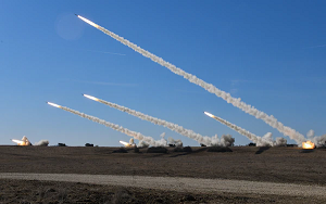
ASAT missiles, regardless of payload, and space debris are concerns or threats to the current GPS orbital architecture. An ASAT missile with a nuclear payload can cause an electromagnetic pulse, a deliberate burst of energy that ends the utility of electronics in orbit and on the ground. In 2008, China launched a non-nuclear ASAT missile against one of their own defunct satellites, which created thousands of pieces of space debris. More recently, Russia demonstrated their capability by striking a defunct orbiting satellite in 2021. Again, this demonstration created added debris that threatens current orbiting satellites and manned missions, including the International Space Station. Debris travels at approximately 17,500 miles per hour in orbit and has the potential of unleashing the Kessler Effect, which is an exponential increase in fragments caused by collisions from other materials in orbit. A Kessler Effect can affect all other satellites in an orbit that support LSCO: communications, sensors, and imagery. In other words, the world goes “dark” and rewinds back to the economic period of pre-GPS due to space debris congestion.
A System and Center of Gravity
GPS supplies extremely accurate PNT data connected to a larger system supporting other digital and mechanical means. Space and GPS reliance enhances military roles, responsibilities, our common operating picture, as well as  command and control, specifically with targeting, precision munitions, BLOS communications, intelligence collection, imagery, and the Internet of Things. A system is groups or combinations of interrelated, interdependent, or interacting elements forming collective entities.7 For the US, GPS is a center of gravity, a physical entity that serves as a primary component of strength.8 If an adversary interfered with GPS signaling or destroyed a satellite, navigation efforts could slow or cease. In addition, GPS supports defensive standoff; in current Eastern Europe, for example, Russia has exhausted their precision munitions and thus must use dummy rounds for strike, which risks their air assets against Ukrainian defenses.
Without GPS, our military receivers, which are paramount for precision fires and maneuver, become inoperable. Loitering munitions and other types of drones depend on GPS for precision fires and navigation; in the absence of GPS, those machines lose the relative advantage they provide, or effects delivered. Without GPS, expeditionary capabilities and forward deployment from power projection platforms could be disrupted; transportation relies on GPS. Machine learning and AI may experience degradation, disruption, or curtailment because of the system connection between GPS and the Internet of Things. The Bretton-Woods economic system of today, which includes finance, energy, agriculture, and commercial transportation sectors all rely on GPS and PNT capabilities. If GPS goes offline, further friction arises in the Strategic Support Area, specifically limited access to finance, digital applications, logistics, emergency services, and agriculture. Failure of GPS protection equates to added fog and friction, both in the homeland and on the battlefield.
Solution One: Long-Range Navigation (LORAN)
LORAN is World War II technology that is still used for commercial transportation, relying on radio pulse transmissions via radar stations for navigation. Updated versions of LORAN were born after World War II to enhance positional accuracy; GPS nearly made it obsolete. The latest version, enhanced LORAN (eLORAN), serves as a backup for GPS in providing PNT and may be a capability to consider for future battle.9 As part of a GPS PACE plan, the Army could initiate eLORAN “re-trans” teams that would establish radio pulses for navigation. In essence, we could build a network that is resilient and enables units to continue executing their missions in a GPS-contested environment with known location, distance, and direction. The current version emits a signal over a million times stronger than GPS, making is difficult to disrupt electronically. In addition, eLORAN is clock-based and performs the same timing functions as GPS, which is essential for encrypted communications.10
Solution Two: Quantum Compass

Quantum Compass is another potential capability offering PNT resilience. This tool is an instrument that measures velocity over time using a starting point. It does not rely on external signals like GPS and thus lacks its vulnerability to interference and disruption. In addition, this tool can calculate known locations, which offers precision. The capability allows navigation without synchronizing GPS satellites. Although in its infancy and still theoretical, this tool could supplement current handheld navigation devices. It would measure velocity against one’s starting point for precise location, with the potential for computing distance, direction, and installing waypoints.11 Current military handheld navigation devices and receivers are susceptible to enemy electronic interference; however, there is no known law of physics that could disrupt Quantum Time, Navigation, and Sensing (TNS) technologies.
Solution Three: Inertial Navigation Systems (INS)

Another capability is an expansion of INS. This technology exists in our military aviation, artillery, armor, and deep-sea assets as a redundant capability in case of GPS degradation or disruption. However, it is not available for all ground combat assets. INS is a self-contained, non-radiating, non-interference, dead reckoning system.12 It is capable of detecting accelerations and angular velocities and then transforming those into a current position and orientation.13 In case of GPS interference, we could incorporate this system in our modernization efforts and equipment for all ground combat assets as an augmentative tool for GPS interference mitigation.
Conclusion
We need to consider options for navigation for the battlefield of 2040. GPS has served as a reliable capability since 1991 for military operations. However, we can no longer count on its continued reliability, given a contested Space Domain. Adversaries are modernizing, especially in capabilities that will disrupt or neutralize our assured PNT. A method of preparedness for space conflict is through a navigation “PACE” plan. These are solutions proposed to overcome kinetic and non-kinetic actions during LSCO. Some solutions are available now (eLORAN / INS) while some remain theoretical (Quantum Compass). We must not be slow to innovate and acquire what we need for the defense of space, especially with a focus on strengthening our GPS architecture and kill chain network. In the battlefield of 2040 and beyond, denied PNT means machine learning, autonomous systems, and the Internet of Things could be severely degraded or entirely unavailable.
If you enjoyed this post, check out the following related content:
Space: Challenges and Opportunities
Star Wars 2050 and The Final Frontier: Directed Energy Applications in Outer Space, by proclaimed Mad Scientist Marie Murphy
Beyond Space and associated podcast, with proclaimed Mad Scientist Kara Cunzeman
Space 2035: A Surplus of Uncertainty and a Deficit of Trust, by Maj Rachel Reynolds
Table of Future Technologies: A 360 Degree View Based on Anticipated Availability, by Richard Buchter
… as well as the Dr. Moriba Jah on What Does the Future Hold for the US Military in Space? podcast hosted by our colleagues at Modern War Institute.
About the Author: CPT Matthew R. Bigelow is currently a Force Manager at United States Army Central, Shaw Air Force Base, and recently served as a Small Group Leader for the United States Army Military Police School Captains Career Course at Fort Leonard Wood, Missouri. His previous assignment was as a Company Commander for the 591st Military Police Company, Fort Bliss, Texas.
Disclaimer: The views expressed in this blog post do not necessarily reflect those of the U.S. Department of Defense, Department of the Army, Army Futures Command (AFC), or Training and Doctrine Command (TRADOC).
1 Mark Episkopos “Russia Jammed GPS Signals During a NATO Military Exercise. That’s a Really Big Deal. And Moscow is perfecting its very own GPS system,” The National Interest, December 01, 2018, https://nationalinterest.org/blog/buzz/russia-jammed-gps-signals-during-nato-military-exercise-thats-really-big-deal-37682.
2 Robert Hoffman, “Lost on The Next Battlefield: The Need to Replace GPS”, U.S. Army War College, January 21, 2022, https://warroom.armywarcollege.edu/articles/lost/.
3 Captain John K. Vintar, “The Blitzkrieg Legend-The 1940 Campaign in the West”, The Blitzkrieg Legend-The 1940 Campaign in the West, Karl-Heinz Frieser, Canadian Army Journal, Vol. 9, 2 (2006): 133-136; Rear Admiral Kazuo Itoh, “Battle of Tsushima was Real Network Centric Warfare”, https://www.e-nsr.com/data_files/view/9.
4 Claudette Roulo “What on Earth is the Global Positioning System”, U.S. Department of Defense, December 26, 2018, https://www.defense.gov/News/Feature-Stories/story/Article/1674004/what-on-earth-is-the-global-positioning-system/.
5 Carl von Clausewitz, On War, trans. J.J. Graham (Ware: Wordsworth, 1997), 8.
6 Sun Tzu, Art of War, trans. Samuel B. Griffith (New York: Oxford University Press, 1963), 69
7 Arnold D. Ross and John P. Wade, “A Definition of Systems Thinking: A Systems Approach”, Procedia Computer Science, 44 (2015): 675.
8 Dr. Joe Strange, Centers of Gravity & Critical Vulnerabilities: Building on the Clausewitzian Foundation So That We Can All Speak the Same Language, (Quantico, Virginia: Marine Corps University, 1996), 3, 12.
9 Matteo Lucio, “The Return of Loran”, xyHt, November 06, 2020, https://www.xyht.com/gnsslocation-tech/the-return-of-loran/.
10 Greg Milner, Pinpoint: How GPS is Changing Technology, Culture, and Our Minds (New York: W.W. Norton & Company, 2017), 166.
11 Hayley Dunning, Thomas Angus, and Martin Sayers, “Quantum ‘Compass’ could allow navigation without relying on satellites”, Imperial College London, November 09, 2018, https://www.imperial.ac.uk/news/188973/quantum-compass-could-allow-navigation-without/.
12 B. Barshan and H.F. Durrant-Whyte, “An Inertial Navigation System for a Mobile Robot”, 1st IFAC International Workshop on Intelligent Autonomous Vehicles, Hampshire, UK, 18-21 April, Vol. 26, 1 (April 1993): 54.
13 Kevin J. Walchko, Michael Nechbya, Eric Schwartz, and Antonio Arroyo, “Embedded Low Cost Inertial Navigation System” (paper presented at the Florida Conference on Recent Advances in Robotics, Florida Atlantic University, May 8-9 , 2003, 1.